Why the canyon defines the trek
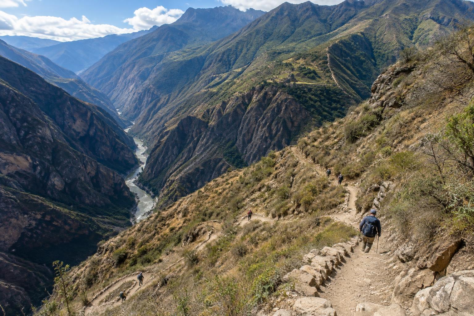
Choquequirao rewards walkers with mountain scenery and time to explore an Inca archaeological site, but reaching it is not a gentle approach. The main trail drops deep into the Apurímac canyon before climbing toward the site. On an out-and-back trip, you must repeat that crossing in reverse. The descent that feels manageable on the way in becomes a sustained climb on the way out.
Distance alone is therefore a poor measure of difficulty. Long exposed slopes, uneven footing and changes in temperature can make a walking day feel harder than its length suggests. Conditions vary with season and weather, so a sensible plan leaves room for a slower pace rather than treating each stage as a fixed timetable.
The main approach: down, across and up
A common starting point is Capuliyoc. From there, the path descends through the canyon, often with an overnight stop around Chiquisca before continuing toward the river crossing near Playa Rosalina. The climb on the far side passes Santa Rosa and Marampata on the way to Choquequirao. Exact stopping points depend on your pace, accommodation or camping arrangements, and the condition of the trail.
This sequence matters when you pack and plan. Downhill walking can be hard on knees and toes, particularly with a heavy bag, while the climb after the river demands patient effort. Start walking early enough to avoid rushing, carry water suited to the day’s conditions, and ask locally where it can be safely obtained or treated. Do not assume that a marked place on a map will have supplies when you arrive.
The return follows the same basic pattern: descend from the site toward the river, then regain the height lost on the original approach. Save energy for that final ascent. If your schedule depends on completing it at a particular speed, you have little margin for heat, fatigue or a change in conditions.
Choosing an itinerary
An out-and-back route is the most straightforward option to understand and arrange. Some walkers divide it into fewer, longer days; others allow extra time for the canyon crossing and for exploring Choquequirao. The slower choice can be especially worthwhile if you prefer to walk without racing daylight. Build the site visit into the itinerary rather than assuming you will have ample energy after a hard approach.
Longer routes can continue beyond Choquequirao through remote terrain, sometimes as part of a journey toward the Machu Picchu region. These are substantially different undertakings, not simple extensions of the standard return walk. They call for careful route planning, appropriate equipment and reliable, current local information about paths, crossings, camps and onward transport. A route that looks connected on a map may not suit your available time or experience.
Before committing to any version, confirm the current trail and river-crossing arrangements, access requirements and practical options for food, camps or lodgings. Local operators can help with logistics, but compare what is included and make sure the pace suits the walkers in your group.
Preparing for steep and exposed walking
Comfort with repeated climbs and descents is more useful here than confidence on flat paths. If possible, prepare with walks on uneven hills while carrying the weight you expect to take. Well-fitting footwear, sun protection, layers for changing temperatures and a way to treat water all deserve space in your kit. Trekking poles may help some walkers on the long descent, provided they know how to use them on rough ground.
Travel light without leaving out essentials. Weather can change, and shade or water may be limited on exposed stretches. Check a forecast before setting out, but be ready to adjust your plan on the trail. If you are unsure about the terrain, navigating independently or managing several days’ supplies, seek experienced local support rather than relying on a rigid online itinerary.
Make time for the place, not just the trail
Choquequirao is more than a turnaround point. Allow time to walk around the archaeological area, follow site guidance and take in how its terraces and structures sit within the mountain landscape. Treat paths, walls and any restricted areas with care; access arrangements may change to protect the site or visitors.
The route also passes through places where people live and work. Use established paths and facilities, ask before photographing residents, and dispose of waste responsibly. A well-paced trek gives you more room to appreciate both the landscape and the journey through it—without making the final canyon climb an avoidable race.