A high-mountain walk, not a casual stroll
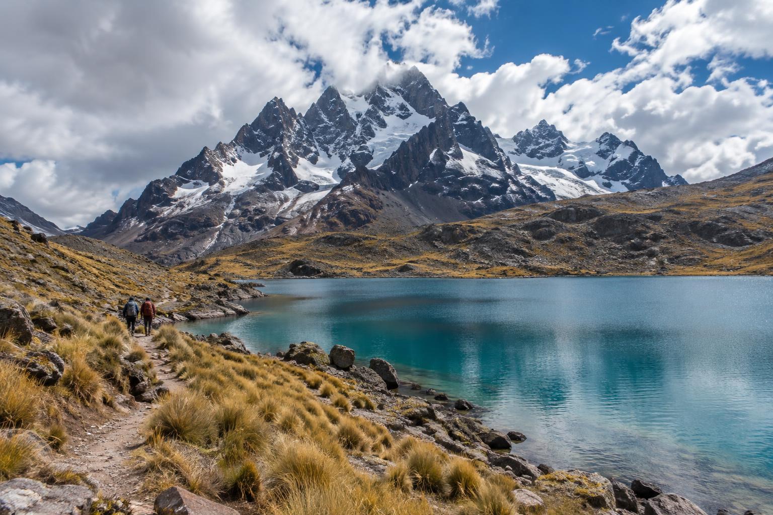
Condoriri is a group of striking peaks in Bolivia’s Cordillera Real, north of La Paz. Its sharp ridgelines and mountain lakes make it appealing to walkers who want to experience the landscape without climbing. The distinction matters: a walk toward a lake or viewpoint is very different from a summit attempt, which can involve technical terrain and mountaineering equipment.
The area is high enough for altitude to shape even a modest day out. Walk slowly, allow time for rests and choose a route that matches how you feel rather than how far you usually walk at home. Before setting off, check the day’s weather, road conditions and local access arrangements. A walk that looks straightforward on a map can take longer when the path is rough, visibility falls or your group needs frequent breaks.
Choice one: keep the day short around the approach lakes
If you have limited time or are unsure how you will respond to the altitude, a shorter out-and-back near the road-accessible approach to Condoriri can be a satisfying choice. From the Tuni side, walkers can take in open views of water, grassland and the surrounding mountains without committing to a long climb. Decide on a turnaround point before leaving, then reassess as you go; reaching a particular landmark need not be the measure of a good day.
This option also leaves more room for an unhurried start and for changes in the weather. Stay on existing tracks where possible, especially near wet ground and lake edges, and give grazing animals plenty of space. The exact place to start will depend on your transport and the access arrangements in effect when you visit, so confirm both locally rather than assuming every track shown on a map is open to visitors.
Choice two: walk toward Laguna Chiar Khota
For walkers with a full day and some time to adjust to the elevation, an out-and-back toward Laguna Chiar Khota offers a closer view of the Condoriri peaks. The lake is often used as an approach point for mountain activities, but reaching it on foot does not require continuing toward a glacier or a summit. Set a steady pace on the outward leg and reserve enough energy and daylight to return by the same route.
Carry a reliable map or offline navigation, but do not rely on a phone alone: paths can be faint or split, and cloud may obscure the peaks you were using as landmarks. Ask locally about the best starting point, the condition of the track and any access fees or permissions. If the route proves slower than expected, turning back before the lake is a sensible decision, not a failed walk.
Choice three: add a viewpoint only if conditions allow
A stronger walking group may prefer to gain some height on an established, non-technical path for a broader view of the lakes and ridges. Treat this as an optional extension, not an automatic next step after reaching the lake. Steeper ground, loose stones and exposure can make a short distance feel demanding, particularly at altitude. Ask someone with current local knowledge which walking routes are suitable before choosing a higher objective.
Keep a clear boundary between hiking and mountaineering. Do not step onto snow or ice, cross a glacier, or follow a line toward a peak simply because others appear to be doing so. If you cannot identify a safe walking path, or if cloud, wind or fatigue reduces your margin for error, stay lower and turn back. Condoriri’s views do not depend on reaching the highest point available.
Plan the return as carefully as the outward walk
Pack layers for sun, wind and sudden cold, along with water, food, sun protection and a way to navigate without mobile reception. Tell someone your intended route and return time. If you are new to high-altitude walking, allow time to acclimatise before making Condoriri a big day, and keep your plans flexible. Headache, unusual fatigue or other symptoms that worsen with continued ascent are reasons to stop climbing and seek appropriate help.
Travel arrangements are part of the walk: agree on your pickup point and timing before you set out, particularly if your route has more than one possible finish. A local guide can help with navigation, access arrangements and route choice without turning the outing into a summit expedition. Wherever you walk, carry out your rubbish, avoid disturbing wildlife and respect the people who live and work in the area.